


localisation spatiale
Ancrage temporel
Données 3D brutes (nuage de points produit à partir de photographies) ▼
Ressources répertoriées
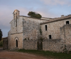
vue en 2009
© UMR CNRS/MCC 3495 MAP
--> chapelles.provence.free.fr
--> dignois.fr
--> varvillages.perso.sfr.fr
--> www.monumentum.fr
--> www.patrimoineprovenceverte.fr
--> fr.wikipedia.org
--> structurae.info
vue en 2009
© UMR CNRS/MCC 3495 MAP