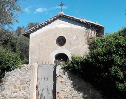
chapelle près du cimetière | Camps-la-Source (Var)


Longitude: 6.097, Latitude: 43.387, Altitude: 291 m
localisation spatiale
Ancrage temporel
Ressources répertoriées

vue en 2016
© UMR CNRS/MCC 3495 MAP

vue en 2016
© UMR CNRS/MCC 3495 MAP


