


localisation spatiale
Ancrage temporel
Ressources répertoriées
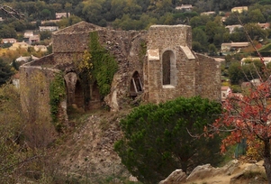
vue en 2016
© UMR CNRS/MCC 3495 MAP
--> randojp.free.fr
--> www.collobrieres-tourisme.com
--> www.culture.gouv.fr
--> www.monumentum.fr
--> www.patrimoine-religieux.fr
--> www.ruines-saint-pons-collobrieres.com
--> www.visitvar.fr
--> fr.wikipedia.org
--> www.fondation-patrimoine.org
vue en 2016
© UMR CNRS/MCC 3495 MAP