chapelle Saint Jean | Alleins (Bouches du Rhône)


Longitude: 5.150, Latitude: 43.691, Altitude: 259 m
localisation spatiale
Ancrage temporel
Ressources répertoriées
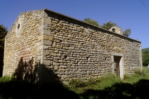
vue en 2017
© UMR CNRS/MCC 3495 MAP
--> chapelles.provence.free.fr
--> jalladeauj.fr
--> www.ot-massifdescostes.com
--> fr.wikipedia.org
vue en 2017
© UMR CNRS/MCC 3495 MAP